• Abandoned platform in Waltham

  • Discussion relating to commuter rail, light rail, and subway operations of the MBTA.
Discussion relating to commuter rail, light rail, and subway operations of the MBTA.

Moderators: sery2831, CRail

  by TrainManTy
 
I often commute to work via the Fitchburg Line, and sometimes ride at the very front of the train when I walk forward and can't find a seat. This gives me a view out the front of the train via the cab car.

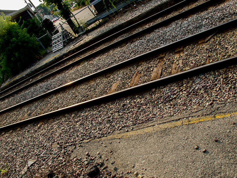
I've found an old commuter rail platform in Waltham, a little bit east of the current platform. There's only about ten feet of it left, but it's unmistakable with its yellow stripe and "please stand back" lettering identical to that in Lincoln and other Fitchburg Line stations. It's right next to Waltham Lumber Company, almost underneath the Main Street / MA-20 bridge. Here's a Google Maps link showing the section of platform:

https://maps.google.com/maps?daddr=42.3 ... sz=20&z=20

Does anybody know the history behind this platform?
  by The EGE
 
Beaver Brook. According to NE Transit's history, closed along with Clematis Brook (at Beaver Street, confusingly enough, about a mile inbound) in June 1978.

In this Google Maps Street View, you can see the platform on the left across the tracks, and the gate in the fence on the right. https://maps.google.com/maps?hl=en&ll=4 ... 91,,0,9.69
  by The EGE
 
On Google Earth, it looks as though there was significantly more of the platform intact until about 10 years ago.

There's also these stairs built from the US-20 bridge to Massasoit Street, presumably for station access: https://maps.google.com/maps?hl=en&ll=4 ... 7,,0,-1.74
  by Ron Newman
 
I was on a Fitchburg train a few years ago that used one of these long-discontinued stops to transfer people to a shuttle bus to get around some track construction.
  by theseaandalifesaver
 
I thought passengers weren't allowed in the control car ever.
  by sery2831
 
theseaandalifesaver wrote:I thought passengers weren't allowed in the control car ever.
Peak trains have the control car open... All off peak trains the control cars cannot be used.
  by TomNelligan
 
Beaver Brook station (named for the body of water that crosses under the tracks just to the east) had minimal service by the 1970s, and no shelter, station building, or parking lot. That, plus the frequent route 70/70A bus service at the same location made it an easy choice for closure.
  by saulblum
 
I live nearby so I walked over this evening.

Here are some photos I took --

http://www.flickr.com/photos/87614014@N ... platforms/

There are actually remnants of platforms on both sides of the tracks.

Image

Here are two photos from the '30s that I found --

http://al-g.smugmug.com/keyword/bm#!i=2 ... 4&lb=1&s=A
http://al-g.smugmug.com/keyword/bm#!i=2 ... u&lb=1&s=A

From the first image, it seems that the street that branches off of Main Street before the overpass used to have a grade crossing with the tracks as it joined Massasoit Street. Workers from Waltham Lumber repeatedly opened the gate and crossed the tracks. Assuming that this view is looking inbound, then I would have been standing where those two well-dressed gentlemen are standing, but now behind a short fence.
  by BostonUrbEx
 
The EGE wrote: There's also these stairs built from the US-20 bridge to Massasoit Street, presumably for station access: https://maps.google.com/maps?hl=en&ll=4 ... 7,,0,-1.74
Doubtful, IMO. The bridge was probably built after the station was abandoned, as a part of some grade separation project. Massasoit was the original US-20, and then they built the bridge to run around the crossing, and then they severed Massasoit when complete. The stairs are probably for the convenience of Bright St residents.
  by MBTA3247
 
saulblum wrote:Here are two photos from the '30s that I found --

http://al-g.smugmug.com/keyword/bm#!i=2 ... 4&lb=1&s=A
http://al-g.smugmug.com/keyword/bm#!i=2 ... u&lb=1&s=A

From the first image, it seems that the street that branches off of Main Street before the overpass used to have a grade crossing with the tracks as it joined Massasoit Street.
What you're looking at *is* Main St, prior to whenever the B&M grade-separated the crossing. As others have noted above, the original stretch of Main St there subsequently became part of Massasoit St.
  by saulblum
 
MBTA3247 wrote:What you're looking at *is* Main St, prior to whenever the B&M grade-separated the crossing. As others have noted above, the original stretch of Main St there subsequently became part of Massasoit St.
Ah, I did not even consider that possibility.

This 1875 map bears that out.

Image

I'll walk over the Route 20 bridge today and see if it has a plaque indicating when it was built.
  by butts260
 
I was born in Waltham, on Lyman St., in 1923, and I distinctly remember the Rt 20 bridge - bright green then - well before my family moved to NYC, in the spring of 1936. I think I remember the grade crossing before the bridge, so I'd guess it went up between 1929 and 1935.